
In this post
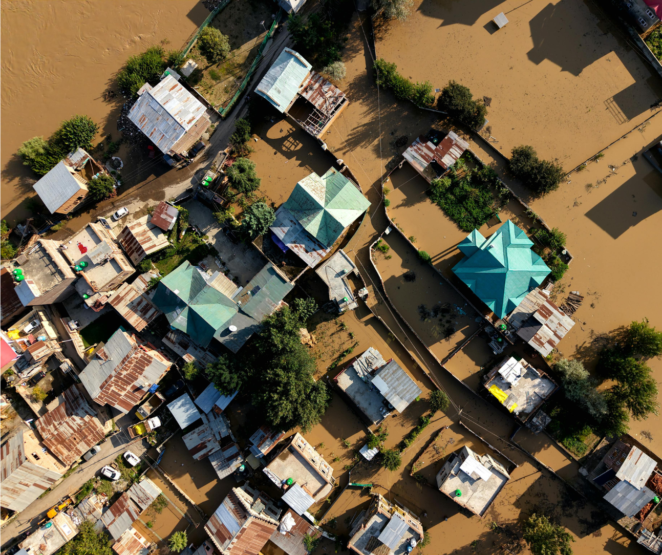
Every meal we eat, every food that lands on our table is the result of a global complex network of decisions and interactions, from how crops are grown to how every single raw ingredient is stored, transported, and eventually traded. Food undergoes a series of processes that are making the system ever so increasingly fragile. Just considering the number of yearly droughts, floods, the ever-evolving rainfall patterns, and land degradation are putting a strain on our delicate ecosystem by impacting resources and exposing weaknesses in the food systems we rely on continuously.
Ecosystems cannot be saved on their own, and our interconnectedness makes us globally reliable on other countries' processes. Therefore, a water shortage in one region can raise food prices on another continent. Extreme weather events can lengthen journeys or cut transport routes, limit exports, and disrupt supply chains in ways that affect both producers and consumers.
Understanding these dependencies isn’t just an academic exercise; it’s essential to improve food supply resilience.
Making the invisible forces that impact our food visible
Many of the factors that influence food production and distribution are invisible from the ground. Soil moisture, vegetation stress, surface temperature, and land-use change evolve gradually, long before they cause visible impact.
That’s where translating Earth observation (EO) data and combining them with AI can have a positive impact and change the way we see the challenges. Satellite data can monitor these environmental indicators at global scale and near-real time, giving decision-makers the information they need to anticipate problems and disruptions, whether that’s a drought threatening crops, a flooding irreparably damaging the land or extreme weather conditions disrupting logistical infrastructure.
By creating large datasets from satellite images and training AI to detect anomalies, measure trends, and highlight areas of concern quicker and more accurately we can give the power to agrifood industries to act on these challenges faster than ever before.

Connecting data to decisions
Tracking food systems means more than monitoring crops. Nowadays, we have developed a better understanding of the interactions between climate, water, soil, and human activity. Being able to see how these factors interact gives us unprecedented power. When these relationships are visible, governments, insurers, and supply-chain managers can act early: reallocating resources, improving logistics, or supporting affected communities before crises hit or escalate. For example:
-
Farmers can implement soil protection strategies by using localised drought, flood, or degradation indicators.
-
Public administrations can plan food-security scenarios informed by real environmental data.
-
Private companies can evaluate sourcing risks and build more resilient supply chains to ensure food security and control price increase.
In each case, insight on risks leads to prevention and prevention means food resilience.
Why it matters now
Earth Observation satellite-based monitoring, combined with AI, provides the right tools to make visible the invisible signs of evolving times, needed to move from reactive crisis management to proactive risk mitigation.
Resilient food systems are those that learn continuously how to better manage their resources, vulnerabilities, and dependencies. By turning Earth data into usable knowledge, we can strengthen that learning process and help ensure that food remains accessible, affordable, and sustainable for everyone.

How SPAI helps build more resilient and sustainable supply chains
In the end, turning data into action requires more than just access to satellite imagery. It demands the ability to interpret change at a larger scale, translate it into clear indicators (we call them pulses), and deliver insights where decisions are made.
That’s what SPAI, Earthpulse’s AI-powered climate intelligence platform, is designed to do. It brings together Earth Observation data, AI models, and analytics that are easy to understand and easy to use to give organisations a continuous view of the factors shaping their supply chains.
SPAI can be used by stakeholders to:
-
Monitor regions for precipitation and soil moisture anomalies, or vegetation stress leading to drought to anticipate yield fluctuations floods related to weather risks.
-
Track land-use change or deforestation that may affect sourcing and compliance.
-
Assess transport routes exposed to wildfire, landslides, floods related to weather risks.
-
Integrate climate indicators directly into operational dashboards or sustainability reports.
SPAI helps organisations move from reaction to foresight, supporting agrifood industries to build supply chains that are efficient, responsible, and resilient.
About the author: Paco Moral is EO Data Scientist at Earthpulse.


